In late 2015 and early 2016, high water levels throughout the Mississippi River system created a rash of problems for the U.S. barge industry. All along the system, navigation was disrupted as barges broke loose in multiple locations, grain elevators and terminals closed in Illinois and the Bonnet Carré Spillway was opened to handle the overflow before it caused flooding problems for New Orleans.
“Rivers are constantly changing,” NOAA’s North Central River Forecast Center’s Steve Baun said during a session at the Inland Marine Expo in St. Louis earlier this month. “Forecasting is critical.”
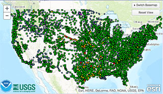
To that end, the National Weather Service’s web resources through NOAA’s Advanced Hydrologic Prediction Service was created. The web site contains a treasure trove of weather information for the inland industry. Pages include a national map, regional maps, precipitation charts, interactive snow information, flood inundation map and much more. “You can customize your own river information,” said Baun. “You can set up your own weather page for your company.”
In an interview following the session, Baun said NOAA has put together this multilayered information guide to help combat high and low water problems, but industry itself is also a critical component. The NWS, Coast Guard, Corps of Engineers, U.S. Geological Survey and industry have to work together to get the best results. “Everybody sharing what they know is vitally important,” he said.
Baun said industry has the system covered better than any other group. “All the boats that are out there all over the system at any given time. Their communicating with each other and with the other entities involved is essential,” he said.
Communication, the sharing of information, is the linchpin to increased safety during high and low water instances, Baun said. “There are situations where accidents happened, where people didn’t have the information that could have prevented the accident if those involved had been provided it.”


