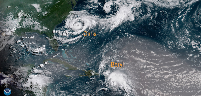
The atmospheric and oceanic conditions that are conducive to rapid intensification are essentially the same conditions needed for formation of a tropical cyclone in the first place.
This means that they are almost continuously monitored by weather satellites, radar, balloons, regularly submitted ship observations and occasionally by aircraft. Tons of data is generated, numbers are crunched, and prognostications made. But it is not about certainties, of which there are none. It’s all about highly variable and subjective probabilities, how they are come by, and what you choose to do with them.
The area that you’re operating in or are near to or heading towards, may be experiencing conditions that range from very favorable to very unfavorable (or in between) for further development or strengthening. This is determined by meteorologists who often disagree on the interpretation of the data, just as their computer models (represented by the spaghetti diagrams) vary in degrees. So, we’re simply being given the best guess as to what is deemed most likely to occur, based on data that is mostly a snapshot in time, updated every six hours as new data is obtained and reinterpreted. There can never be a guarantee.
I give all tropical cyclones the respect they deserve and a correspondingly wide berth. Because if a “simple” tropical depression (or even just a wave) suddenly begins undergoing unpredicted rapid-intensification while we have foolishly strayed too close to it, we may wind up in a situation where all or most of our escape options are taken away with equal rapidity. Rare would be the circumstances where a conventional tug and tow could hope to comfortably outrun a close-range cyclone on the move.
To this end, the minimum safe distance I try to keep between us and a cyclone or potential cyclone isn’t based so much on the strength of it in a given moment but rather on its potential, especially early on in the process.
Thus, I regard them all as potentially lethal, and then act accordingly.


