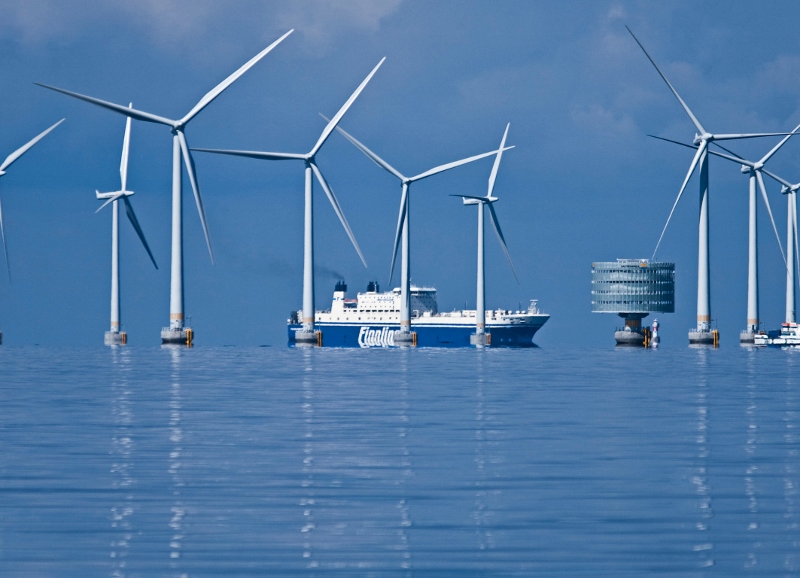
Better planning for safe navigation corridors, with changes to traditional maritime routes and offshore wind energy zones, are critical to reduce hazards as the United States develops offshore wind power arrays, a Coast Guard study found.
A final draft of the Atlantic Coast Port Access Study released July 8 has some examples of how the Bureau of Ocean Energy Management’s wind energy lease areas and maritime industries could adapt.
As BOEM moves forward with leasing – most recently near heavily trafficked sea lanes off New York and New Jersey – care must be taken to keep margins of safety, the report says.
That includes safe navigation corridors wide enough to minimize close encounters between vessels, and reduce the dangers not only of allision with turbine towers but collision among vessels constrained by the wind energy area (WEA) arrays.
For deep-draft vessels, the corridors need adequate draft and space for ships to safely make complete turns without danger. Planners must also consider whether they are in fact increasing the hazards to smaller vessels.
“Rerouting (displacing) traffic may also increase the weather related casualty risk to smaller vessels engaged in coastwise shipping by forcing them further offshore, where they will be subjected to larger sea states, and where their transits will be commingled with deep draft vessels moving at higher speeds,” the report notes.
In the case of wind lease areas between New York and Philadelphia, the Coast Guard working group devised a jog to move a traditional towing nearshore route past the mouth of Delaware Bay. That is an alternative to pushing tows as far as 35 miles offshore, into routes used by bluewater cargo ships.
“Based on initial evaluations, the highest conflict between tug and barge routes and proposed WEAs occurs along the coastwise routes,” the study says. “In many cases proposed WEAs such as at the entrance to Delaware Bay, if fully developed, would displace tugs and barges forcing them to transit further inshore or offshore from their traditional routes. “
The inshore options have their own complications, like converging shipping lanes and pilot boarding areas, “increasing traffic density and creating complex crossing situations,” the report notes. “Through the application of the Planning Guidelines and consideration of alternate routes, alongshore towing and wind energy development can coexist with some modifications to existing wind energy/lease areas.
For potential wind power areas off North Carolina, the planners listened to industry sources who warned against forcing towing vessels farther offshore into dangerous sea conditions and the Gulf Stream.
After five years of work, the group recommends new planning guidelines to reduce the danger of conflicts. But much more modeling and analysis needs to be done to develop specific measures, they reported.
With the widening of the Panama Canal, numbers of cargo ships moving along the East Coast are expected the double in coming years, the study reports, citing a 2012 projection of the canal’s effects by the Army Corps of Engineers.
“As the numbers of vessels increase, the density along these routes will also increase. Larger vessels will require additional sea room to maneuver,” the Coast Guard reviewers wrote. “Routes that may be suitable in size for shipping today may not be suitable in the future. Routes bounded on both sides with obstructions will be even less desirable from a navigational safety standpoint.”


