


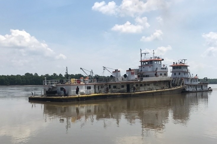
The pilot navigating the 158’ towboat Eric Haney failed to identify an erosion-control dike on the Upper Mississippi River when the vessel grounded and subsequently sank near Cairo, Ill., according to a report by the National Transportation Safety Board.
The Tennessee Valley Towing vessel was pushing 15 empty barges upriver when it grounded around 11:42 p.m. on July 8, 2017, at mile marker 13.4. All nine crewmembers climbed aboard one of the empty barges, and the 3-knot current freed the towboat and barges, which drifted downriver.
Another towboat pushed the Eric Haney and barges toward the right descending bank at mile marker 9.7, where the towboat partially sank. All the crewmembers had escaped without injury, and the towboat was subsequently salvaged with damage estimated at $4.3 million.
The towboat was on a trip to deliver empty barges to St. Louis, stopping along the way to pick up or drop off barges as required. On July 8 the vessel departed Paducah, Ky., with the pilot standing a six-hour afternoon watch on the bridge before going to rest at 6 p.m.
During the evening the crew stopped at a fleeting area near Cairo to build a 15-barge tow of empties. At 10:45 p.m. the pilot relieved the captain, as the Eric Haney was holding up at Hurricane Daybeacon at mile marker 10.7 on the right descending bank, to allow a southbound boat to pass through Greenleaf Bend.
As that vessel passed, the pilot got the Eric Haney under way, and crossed the river to the left descending bank to wait at Antelope Light at mile marker 12.2 while the next southbound vessel, the 140’x42’ towboat Merrick Jones, passed the bend.
At 11:29 p.m., as the Merrick Jones was passing, the pilot got underway once more, steering toward the center of the channel. On the radio he discussed passing arrangements with the 295''x52'x7.5' passenger vessel Queen of the Mississippi, heading toward the bend at about 14 mph. They expected to meet near the top of the bend near Great Lake Lower Light at mile marker 14.1.
The NTSB report describes what happened next:
“Although the operator of the Queen of the Mississippi suggested passing ‘on the 2’ (that is, the vessels would pass starboard to starboard) because he thought the inboard bank (the right descending bank) had less current, the pilot of the Eric Haney wanted to pass ‘on the 1’ (port to port). The Eric Haney pilot continued to transit along the left descending bank.
“Along the left descending bank of the river between mile marker 13 and 14 in the bend, five partially submerged erosion-control dikes constructed of rock and stone protruded from the shoreline. The purpose of the dikes was to reduce strong currents around the river bend and prevent erosion of the riverbank.
“The pilot had set the ECS (electronic chart system) at a 3-mile scale. However, as he stated in a post-accident interview, he did not see the dikes on the display. Just before reaching the dikes, the pilot believed he was about 100 feet off the shoreline.”
As the towboat proceeded upriver at about 6 mph it struck something and stopped abruptly. The pilot stopped the engines, then put them into reverse, but the boat with a draft of 9.5’ would not budge. The captain came to the wheelhouse and said he thought they were on a dike, and zoomed the ECS display to enlarge the dikes on the chart.
With the towboat taking on water, the captain and pilot ensured all crew were accounted for and evacuated them onto one of the barges. After the towboat and barges drifted downriver, another towboat came to pick up the crew and push the Eric Haney to the right descending bank at mile marker 9. A unified command consisting of the Coast Guard, the vessel owner and the Missouri Department of Natural Resources began working to stabilize the vessel and prevent a spill, recovering about 106,000 gals. of fuel and 6,000 gals. of lubricating oil, waste and contact water.
After the vessel was raised July 22 and drydocked, inspection revealed a 5.5' gash in the bottom plate and damage to seven transverse frames, with extensive water damage throughout the interior.
The pilot had 50 years experience on the river and had operated in that area before, but told investigators he was not aware of the dikes and would have steered into the center of the river to avoid them.
NTSB officials noted the pilot was dealing with several issues going into Greenleaf Bend, including reduced speed, the current and oncoming traffic, and shallow water.
“The pilot also told investigators that due to the opposing current, he brought the head of the tow toward the left descending bank after departing Antelope Light to avoid being ‘set out’ into the stronger current,” the report states. “He indicated that ‘the Queen [of the Mississippi] was on my mind, getting up there.’
“The pilot also told investigators that he was using the ECS on a 3-mile scale to better track other vessels and allow himself time to react to what he saw on the screen.”
At that scale, the dikes were not visible on the ECS and at night there was no other indication they were there, investigators noted. The dikes are unmarked and not visible on radar.

A screenshot from the Eric Haney's electronic chart system shows the towboat's position as it near erosion-control dikes on the upper Mississippi River. NTSB image.