


The Corps of Engineers knows it needs lots of money for East Coast beach replenishment as sea level rises. Now, will there be enough sand?
Some answers to that question are coming out from the federal Bureau of Ocean Energy Management, which spread around emergency funding after Hurricane Sandy so partners in state governments and academic institutions could help.
Updated maps and databases about offshore sediment resources from Maine to Florida have been compiled with help from 13 states. Physical samples from those offshore deposits are now being kept at the new Atlantic Sand Assessment Project (ASAP) core storage repository, located at Columbia University’s Lamont-Doherty Earth Observatory in Palisades, N.Y.
Lamont-Doherty is a major institution in the seafloor research community, lending its experts and resources to mapping and profiling projects, including seismic surveys and vibracore sampling. That work includes studies to reconstruct eras of sea level rise and fall over the eons — research that may inform coastal and city planners about what to expect in the present era of tides creeping up on the East Coast.
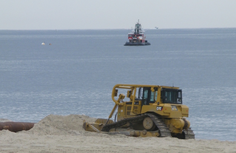
Part of the response is the Corps’ ambitious program to widen beaches in front of heavily developed shore communities. In its North Atlantic Division alone, the Corps is looking to plan some 40 projects over the coming 20 years, with needs for at least 140 million cu. yds. of sand.
That could bring more than 200 contracts worth more than $2.5 billion through the 2030s, said Lynn Bocamazo, chief of the Corps’ Hurricane Sandy Relief Branch.
BOEM used about $6 million in post-Sandy funding for the cooperative mapping effort and core collection projects. Getting the samples “involved collecting, analyzing and cataloging 160 sediment cores offshore 11 East Coast states from Miami to Massachusetts beginning in 2015,” the agency said when it announced the results in late October during the American Shore & Beach Preservation Association conference in Long Branch, N.J.
Those core analyses give beach replenishment project planners critical information on the thickness of seafloor sediment layers, their composition including of organic material content, and whether the sand grain size is an acceptable match to sand already on eroded beaches.
All are criteria for how usable offshore sand deposits are for beach projects. Distance from the shoreline will be another factor for project planners — the further out dredges must go for sand supplies, the higher costs for pumping it ashore.
Off the mid-Atlantic beaches, the most accessible sand comes from ancient post-ice age barrier islands that submerged with rising sea levels. In New York waters, there are an estimated 50 million to 75 million cu. yds. of suitable sand remaining in established borrow areas, according to one of the studies submitted for BOEM.
Off New Jersey, where the Corps has undertaken some of its biggest beach projects since the 1990s, state geologists identified 157.4 million cu. yds. of potential sand reserves beyond previously designated borrow areas.
Critics of beach replenishment have challenged the Corps’ ability to maintain those projects through their 50-year life cycles, with periodic renourishments every three to five years and after major storms. Having those sand reserves identified could strengthen the hand of pro-replenishment supporters.