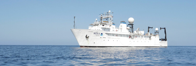
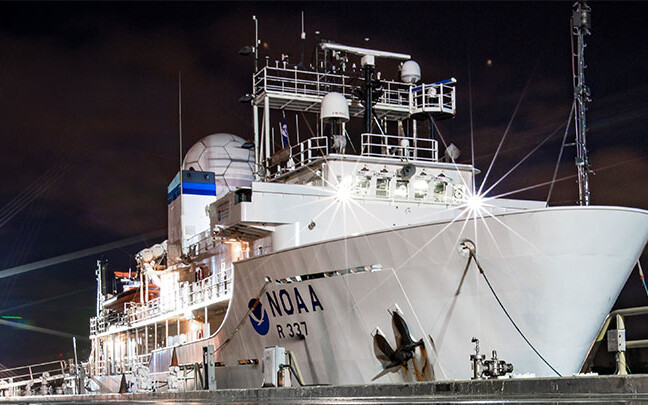
The National Oceanic and Atmospheric Administration's (NOAA) research vessel Okeanos Explorer began the third phase of its Seascape Alaska expeditions last Wednesday. The vessel is expected to return to port in Kodiak, Alaska on July 25.
Phase three is focused on providing 3D models of the seafloor off the Aleutian Islands and Bowers Ridge. These expeditions are part of a regional mapping campaign that supports the 2020 National Strategy for Mapping, Exploring, and Characterizing the U.S. Exclusive Economic Zone.
Alaskan waters contribute the largest area to the U.S. Exclusive Economic Zone (EEZ). Current mapping data accounts for only 34% of Alaska's seafloor, and much of that data predates modern mapping technologies.
The 224’ Okeanos Explorer is equipped with state-of-the-art technologies used to map and explore deepwater ocean areas and phenomena. Remotely operated vehicle (ROV) exploration is conducted between 250 to 6,000 meters using fully integrated dual-body ROV systems, Deep Discoverer and Serios.
Deep Discoverer is equipped with two operator arms, a TechnipFMC Shilling Orion manipulator arm and a seven-function Kraft Telerobotics Predator II manipulator arm. The Predator II manipulator arm contains coral-cutting jaws that can cut and grab delicate coral branches and other specimens.
Additional sonar mapping technologies include:
A Kongsberg EM 304 multibeam sonar device that maps broad swaths and collects bathymetry data and water column features. Last month, the sonar device helped discover what appeared to be evidence of a large gas seep along the Aleutian Trench during phase one of the mapping expeditions. This multibeam sonar is designed to map the seafloor in water depths ranging from 10 to 10,000 meters.
Simrad EK60 and EK80 split-beam sonar transducers, which emit multiple frequencies to obtain higher resolution data. Water column backscatter data from each transducer can detect anomalies in the water column, like fish schools and gas seeps, allowing for insights into the biological productivity of the region.
A Knudsen Chirp 3260 sub-bottom profiler, which provides echogram images of substrate layers up to 80 meters below the seafloor.
The remaining Seascape expeditions planned for 2023:
- July 31 - Aug. 17: Seascape Alaska 4: Gulf of Alaska Deepwater Mapping (Mapping)
Dutch Harbor, Alaska, to Kodiak, Alaska - Aug. 23 - Sept. 16: Seascape Alaska 5: Gulf of Alaska Remotely Operated Vehicle Exploration and Mapping
Kodiak, Alaska, to Seward, Alaska - Sept. 23 - Oct. 14: Seascape Alaska 6: Gulf of Alaska Transit Mapping
Seward, Alaska, to San Francisco
Through live video streaming and telepresence capabilities, scientists from around the world are able to participate virtually in this expedition, actively engaging in real-time exploration and providing their expertise in different areas of marine science.