


A new study from The Water Institute aims to help The Greater Lafourche Port Commission leadership find the best use of dredge material resulting from Port Fourchon dredging and expansion. Results will help improve the resilience of the port, serve long-term needs of local communities, and improve the ecosystem.
The work was done using a “community-informed transdisciplinary approach,” meaning local community members joined with research scientists in order to develop a series of coastal projects that would help protect port infrastructure, provide ecosystem services, improve area resilience, and quantify carbon-capture benefits.
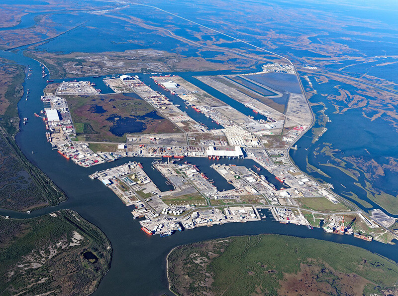
The Port Fourchon facility plays a role in the importation of about 20% of the nation’s oil supply while also being located at the dynamic intersection of Bayou Lafourche and the Gulf of Mexico. Being on the coast is vital to the port, but it also brings challenges since the area experiences some of the highest relative sea level rise rates, shoreline erosion, and land loss in the U.S..
The work started after the port announced in 2016 it was going to pursue permits for the deepening of Belle Pass in order to build additional maintenance facilities. At that time, Port Fourchon leadership also expressed a desire to use that resulting dredged material in the most beneficial way possible.
The next year, the port and energy industry partners Chevron, Shell and Danos, joined with The Water Institute to form the Partnership for Our Working Coast (POWC). Additional funding supporting the work came from the National Coastal Resilience Fund administered by the National Fish and Wildlife Foundation and the National Oceanic and Atmospheric Administration (NOAA).
The goal was to bring together a public/private partnership that could develop a science-based approach to using the dredge material to protect critical infrastructure, provide ecosystem services, improve resilience of the area from Port Fourchon to Larose, and to better quantify the carbon-capture benefits of the restoration approach.
In order to accomplish this, The Water Institute brought together technical experts and local knowledge experts, people who live or work in the area, into an Environmental Competency Group. This group worked to co-develop potential projects in which the dredged material from the port would provide the greatest benefits.
The Water Institute team worked with community and industry stakeholders to analyze a variety of projects based on several criterial including the project’s ability to improve resilience to a changing environment and how the projects could keep up with these changes, such as sea level rise and storms.
A total of 43 beneficial use wetland restoration project sites, organized into six groups, were developed for the study. Using modeling and various potential future conditions such as several sea level rise estimates, The Water Institute team evaluated each of the six groups of projects on a 2020-2050 timeline based on the amount of land change (positive or negative) with and without restoration; storm surge; waves and water level differences over time; and potential to be a greenhouse gas emission sink. The model results were reviewed by residents and key stakeholders to determine which groups of projects would be expected to generate the greatest value for nearby communities. Taken together, the model results and the social value assessment can be used to identify the project grouping that will potentially produce the greatest co-benefits.
The community-research joint approach to participatory modeling actively incorporated the local and traditional knowledge of residents and resource users into the numerical models developed by scientists and other technical knowledge experts. The similarities between the results of the social value model and those of the ecological and hydrodynamic models shows that coastal protection and restoration planning supported by knowledge can result in effective and sustainable results.
You can read the Phase 2 summary, the full report, and appendices here.