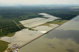
High water from a series of heavy rain systems that battered the Midwest and South since November is making its way down the Mississippi River, with a record-setting levels expected at Cape Girardeau, Mo., this week and flood stage predicted at New Orleans by the third week of January.
Vicksburg, Tenn., is expected to see a river crest of 51’ around Jan. 15, well above the 43’ flood stage but short of a 57’ record set during the spring flood of 2011.
The latest forecasts cap a year of remarkable high water conditions that persisted from March well into summer 2015. Those problems of swift currents contributed to a number of accidents – and fatalities – and seriously affected inland transportation.
 A NOAA map shows the significant river flood outlook through Jan. 1, 2016.The flow also brought a big slug of sediment to the lower river delta, reducing draft in river approaches so much that in August the Associated Branch Pilots of the Port of New Orleans announced tide and time restrictions for moving deeper draft vessels.
Both river pilots and the National Weather Service ascribe this year’s conditions to El Niño, the Pacific Ocean phenomenon of warmer ocean waters and currents that tend to driver big weather systems across North America. This fall and winter, it has brought an extra 10” to 15” of rain in parts of the upper Mississippi and Ohio river watersheds.


