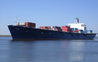
The U.S. Navy has confirmed the location of the El Faro, but the ship’s navigation bridge — where the voyage data recorder was mounted — was separated from the vessel and has not been found.
The National Transportation Safety Board provided an update on the investigation Tuesday, revealing that the navigation bridge and the deck below it were not part of the wreckage discovered on Saturday by the U.S. Navy search team the agency contracted to find the vessel.
The deep-ocean remotely operated vehicle (ROV) CURV-21 has documented both the port and starboard sides of the vessel, which the NTSB said is oriented in an upright position with the stern buried in approximately 30 feet of sediment. The El Faro is located in approximately 15,000' of water in the vicinity of the ship's last known position northeast of Crooked Island in the Bahamas.
Sonar scans of the nearby debris field have not identified any targets that have a high probability of being the missing navigation bridge structure, the NTSB said.
The team aboard the Navy tug Apache plans to continue to use sonar technology to try and locate the navigation bridge by creating a map of the debris field. It was the Orion side scan sonar system that initially returned images of El Faro over the weekend, which the Navy confirmed using the CURV-21 ROV.
The El Faro went missing on Oct. 1 during Hurricane Joaquin with 33 mariners aboard. On Oct. 7, the Coast Guard and NTSB announced that they believed the ship had sunk, and would begin searching the ocean floor for the wreck. The 226’x42’x15’, 7,200-hp Apache, a Powhatan-class fleet tug, left the Navy’s Little Creek amphibious base near Norfolk, Va., on Oct. 19 to begin the underwater search.


