The bridge deck that separated in the Oct. 1 sinking of the El Faro could be a considerable distance from the ship – perhaps a mile or more – as is debris from historic shipwrecks that have undergone forensic study and analysis.
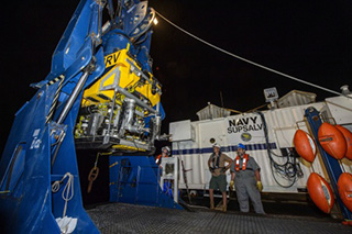
The 790’x95’ TOTE Maritime ro/ro container vessel is in 15,000’ of water near its last reported position in Hurricane Joaquin, and the National Transportation Safety Board says side-scan sonar is being used to map the debris field scattered across the bottom.
The big missing piece is the navigation bridge — where the ship’s voyage data recorder was mounted — and the deck below. Despite their immense size, pieces of sinking ships can travel long distances laterally through the water column on their way to the bottom.
For a wreck in 15,000’ of water, parts of a ship may conceivably separate and fall over an area of that same diameter, said Sean Kery, co-chair of the Society of Naval Architects and Maritime Engineers’ Marine Forensics Committee.
As a rule, SNAME committee members do not comment on ongoing maritime accident investigations. But presentations at the society’s World Maritime Technology Conference 2015 in Providence, R.I., offered some ideas of what the El Faro searchers are up against, as they scan the bottom off the Bahamas, three miles down.
“We’ve seen amazing amounts of damage as a ship sinks to the bottom,” Kery said at a session on analyzing shipwreck debris fields. Flooding compartments, crushing water pressure and finally bottom impacts can break ships apart.
One case was the Edmund Fitzgerald, the 729’x75’ Great Lakes ore carrier that sank 40 years ago Tuesday with the loss of her entire crew of 29. The wreck, broken in half and 530’ down in Lake Superior, is surrounded by a debris field of “metal salad,” shards that came off the ship as it broke up, Kery said.
Another wreck studied by the committee, the 823’x118’ World War II German battleship Bismarck sunk in the North Atlantic in 1940, hit the seafloor at an estimated 20 knots, its heavy gun turrets and other pieces separating on the way down, before the hull slid more than half a mile down the slope of a seamount and came to rest at 15,700’.
Lighter ships with some remaining buoyancy in their compartments can travel farther. Engineering calculations for the water resistance of hulls, masts and rigging help forensic analysis of historic wrecks to model almost fluttering movements as they went to the bottom, Kery said.
Committee members would not comment about the El Faro’s missing bridge. But in a situation like that, Kery said, “in my experience, it could be as far away as the depth…If it had buoyancy, it could have gone farther.”
On Tuesday, the NTSB announced the resumption of the search for the El Faro bridge after operations were temporarily suspended Monday due to Tropical Storm Kate.


