


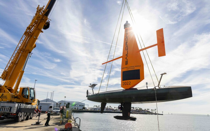
Saildrone is launching two of its 10-meter Saildrone Voyager uncrewed surface vehicles (USVs) from its facility in St. Petersburg, Fla., to begin a mapping mission as part of the Florida Seafloor Mapping Initiative (FSMI),
The project is “a multiyear effort to provide statewide stakeholders with accessible, high-quality, and high-resolution seafloor data of Florida’s coastal waters within the continental shelf,” according to a statement Monday from Saildrone.
Based in Alameda, Calif., Saildrone’s long-endurance USVs have played roles in similar research, from hurricane studies to fisheries related surveys in the Gulf of Maine.
Florida’s 2,170-kilometer (1,348 mile) coastline is second only to Alaska among the U.S. states, and much of the Florida coast remains unsurveyed. Existing nautical charts are based on outdated and low-resolution data, and the Florida Department of Environmental Protection’s mapping initiative aims to provide updated mapping data of coastal system.
Updating that data “is critical for protecting offshore infrastructure, habitat mapping, restoration projects, emergency response, coastal resilience, and hazard studies for the state’s citizens,” according to Saildrone.
“Saildrone is proud to support the Florida Seafloor Mapping Initiative with our unique and innovative Voyager USVs. As a member of the St. Petersburg community, we are excited to contribute to a project that seeks to improve our coastal resilience and enhance our ability to predict storm surge impacts by providing high-resolution bathymetry,” said Brian Connon, Saildrone’s vice president of ocean mapping. “Saildrone USVs efficiently and safely collect high-resolution bathymetric data while minimizing environmental impact.”
The 10-meter (33’) Saildrone USVs will collect high-resolution multibeam data in a region known as Middle Grounds. The $1.66 million mission will map 2,817 square kilometers of seafloor about 130 kilometers (80 miles) northwest of St. Petersburg.
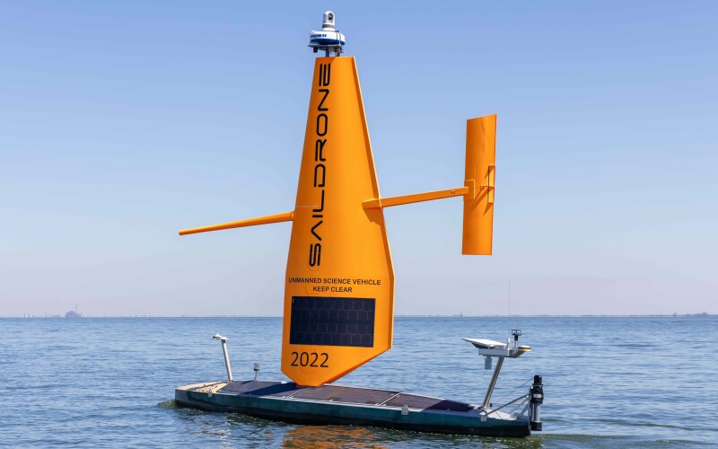
This is the first time that Saildrone has deployed Voyager USVs, equipped with NORBIT WINGHEAD i80s echo sounders for high-resolution mapping, and radar, AIS, and cameras for maritime domain awareness, out of Tampa Bay.
In 2024, Saildrone Voyagers were used to map a portion of the Gulf of Maine to identify deep-water coral habitat. In Florida, Saildrone has previously deployed Voyager USVs for the US 4th Fleet out of Key West and currently has a fleet of Voyager USVs operating in the Caribbean in support of Joint Interagency Task Force South (JIATF-S) and US Naval Forces Southern Command/US Navy Fourth Fleet.
FSMI builds on the efforts of the Florida Coastal Mapping Program (FCMaP), an initiative led by federal and Florida state agencies and other community stakeholders to promote the need for a comprehensive high-resolution seafloor data set of Florida’s coastal waters by 2028. The data will be available to update navigational charts and identify navigation hazards, provide fundamental baseline data for scientific research, and provide information for use by emergency managers and responders.
The data Saildrone collects will help better understand Florida’s coastal vulnerability and hurricane impact, evaluate the performance of restoration projects, and support ongoing coastal resilience efforts and flood risk mapping.