


NOAA has published new seafloor mapping data to support electric power cable planning in the Long Island Sound, between New York and Connecticut.
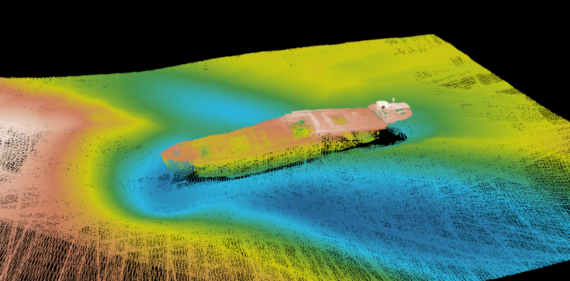
The newly published data will supports efforts to modernize the region’s energy grid and facilitate domestic energy development. The survey covers roughly 170 square nautical miles and includes more than 4,500 linear nautical miles of multibeam bathymetry and backscatter data.
The mapping project is the result of a partnership between NOAA’s Office of Coast Survey and the Connecticut Department of Energy and Environmental Protection (CTDEEP), made possible through NOAA’s Brennan Ocean Mapping Fund. This fund allows non-federal partners to co-finance ocean mapping projects with NOAA’s technical and data expertise.
Selected in the fiscal year 2024 round of the Brennan Fund’s matching opportunity, the project falls under the Long Island Sound Seafloor Habitat Mapping Initiative. The initiative is led by CTDEEP and guided by the Long Island Sound Cable Fund Steering Committee, a collaborative group of federal, state, and academic stakeholders from both Connecticut and New York.
In addition to informing electric cable routing, NOAA said that the mapping data will serve multiple purposes. Consistent with its “Map Once, Use Many Times” philosophy, the agency plans to use the data to update nautical charts and support maritime commerce and navigation safety.
The datasets — surveys H13926 through H13931 — are publicly available through NOAA’s National Centers for Environmental Information Bathymetric Data Viewer.