


A fourth tropical system headed toward U.S. shores is expected to lash parts of the Gulf of Mexico shore between Louisiana and the Florida Panhandle this weekend.
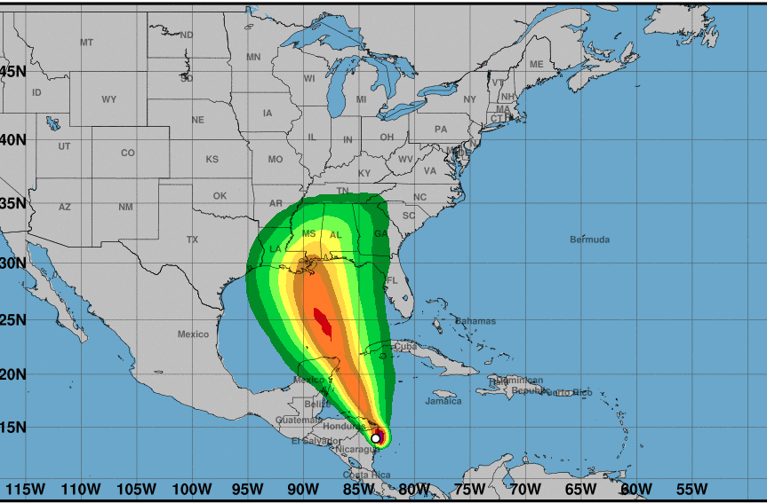
Tropical Storm Nate is expected to strengthen to hurricane force after passing the Yucatan peninsula on its trek north, with a possible landfall in the U.S. Sunday morning, according to the National Hurricane Center.
The hurricane center upgraded Nate from a tropical depression Thursday morning, based on radar data, and forecast continued strengthening. Heavy rain with the danger of flash floods and mudslides were the storm’s main threat to parts of Central America, and Mexico's Cancun and Cozumel resort areas were next in line for impacts.
As of late Thursday morning, offshore oil and gas producers had evacuated six platforms in the Gulf of Mexico, shutting-in about 14.5% of oil production and 6.4% of gas, according to the federal Bureau of Safety and Environmental Enforcement. One of the 18 dynamically positioned rigs in the Gulf, one had been moved from the storm's project path, according to BSEE.
Over warm waters of the northwest Caribbean, Nate is expected to reach hurricane strength, although on Thursday forecast models diverged on its potential development.
Forecasters were fairly confident of a five-day track taking it onto the U.S. Gulf Coast Sunday as a category 1 hurricane with maximum sustained winds of 80 mph.