


Woolpert, a global architecture, engineering, and geospatial (AEG) services firm, is conducting its first fully uncrewed offshore hydrographic survey mission for the National Oceanic and Atmospheric Administration (NOAA), deploying multiple uncrewed survey vessels (USVs) designed and piloted by Lafayette, La.-based Chance Maritime Technologies. The USVs carry Woolpert’s multibeam sonar technology to map the Gulf Coast near Pensacola, Fla.
During the mission, Woolpert will collect 1,391 sq. nautical miles of high-resolution hydrographic survey data to explore deep-sea corals and other marine habitats, identify seafloor hazards, detect changes to the underwater environment, and update NOAA’s nautical charting products to enhance maritime safety.
Chris Taylor, an ecologist with NOAA’s National Centers for Coastal Ocean Science, said the project will fill in gaps in mapping data in the Gulf.
“New maps of seafloor bathymetry and texture will be used by NOAA and our partners to develop new habitat maps and characterizations supporting the restoration of mesophotic and deep benthic communities in the region that were damaged during the Deepwater Horizon oil spill,” Taylor said.
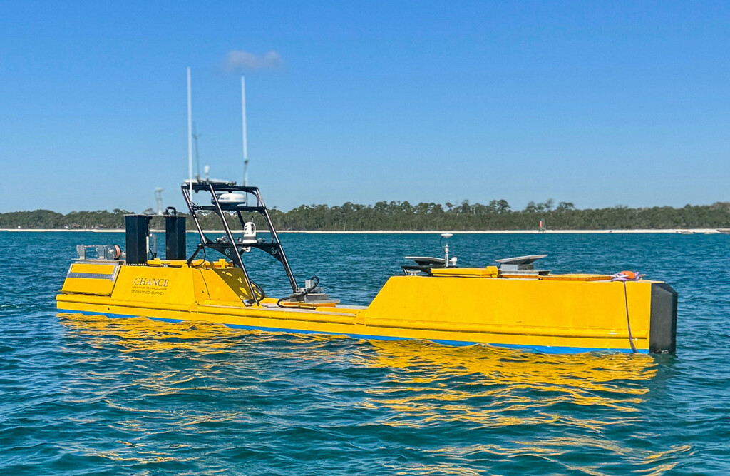
To execute the survey mission, Woolpert enlisted Chance Maritime and its 40' uncrewed survey vessel, the Chance MC40, and a second uncrewed vessel, the Chance MC29.
Over the course of the multi-month project, Woolpert will survey approximately 11,000 linear nautical miles, with Woolpert hydrographers positioned across multiple time zones remotely conducting hydrographic surveys around the clock. Survey data is uploaded to a cloud server via Starlink, inputted into Woolpert’s Automatic Survey Production Environment (ASPEN) and packaged for further postprocessing.
According to Dave Neff, program director for Woolpert, conducting surveys with uncrewed vessels significantly enhances data collection capabilities and are increasingly being used for deep-ocean missions.
“Uncrewed vessels allow us to collect high-quality hydrographic data more efficiently and safely, particularly in challenging deep-ocean environments,” Neff said. “This project demonstrates just how valuable USVs are in expanding our access to critical ocean data while reducing operational risk. We’re proud to support NOAA’s mission and to help set a new precedent for large-scale offshore marine mapping.”
The survey mission is expected to be completed later this year.
This is the second survey mission conducted by Woolpert and Chance Maritime. Last year, the two companies partnered on a hybrid crewed/uncrewed survey mission using the Chance MC29 USV and Woolpert’s research vessel Thunder. That vessel duo mapped more than 6,000 linear nautical miles off the coast of Florida.