


Continuing storms and flooding across the central U.S. are bringing a renewed high water event to the Mississippi River basin, as its tributaries inundated communities in Oklahoma and other states.

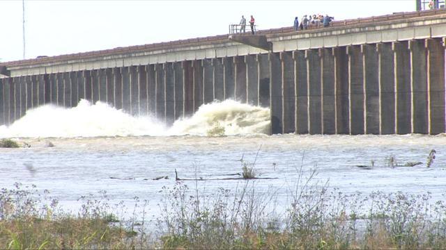
The Webbers Falls Lock and Dam is part of the McClellan-Kerr Arkansas River Navigation System. Corps of Engineers photo
“This is a life threatening situation. If you choose to stay you are doing so at your own risk,” was the message on the town’s Facebook page. Officials in Kansas and Missouri issued warnings for renewed flooding.
At a Thursday press conference Mississippi Gov. Phil Bryant said continuing flooding in the Delta region since winter was unprecedented since the great 1927 flood.
“This may indeed replace that,” said Bryant, tallying the state’s flood zones at 544,000 acres. “This is indeed the great flood of Mississippi.”
The Corps of Engineers says the river has stood above flood stage at Vicksburg, Miss., for 95 days straight, a new record since 1927 – the cataclysmic event that led to the Corps’ massive flood control projects.
At midafternoon Thursday Coast Guard officials announced they had closed parts of the Mississippi and Illinois rivers due to extreme high water and currents sweeping past St. Louis. The city harbor was closed from mile marker 179 to 184 on the Mississippi, and a no-wake order imposed on the Illinois between mile markers 10 and 80.2.
Outside of the St. Louis closed area, the Coast Guard strongly recommended making southbound transits on the Mississippi between mile markers 179 and 168.5 at the JB Bridge only during daylight hours.
The same stretch of river at St. Louis was closed during an earlier bout of high water, when the wheelhouse of a towboat was crushed in an Allison with the city’s Eads Bridge May 2. No one was injured in that incident.
The Bonnet Carré Spillway near New Orleans, which diverts Mississippi River flow into Lake Pontchartrain at times of high water, has already set a record for opening in consecutive years. It is setting a new record with this second high water event, when the Corps began opening the structure again May 10, with 148 bays open as of Thursday as the river gage at Carrollton hovers around 16.8’, just below the city’s 17’ flood stage.
Continuing runoff is expected to bring a second crest on the lower river in Louisiana by May 29.